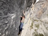
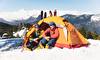
Everest seen from the south
 3drealitymaps
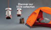
Everest and Dolomites in 3D
Explore Mount Everest and the Dolomites with a 3D application.

 Copia link
 1 / 2
1 / 2
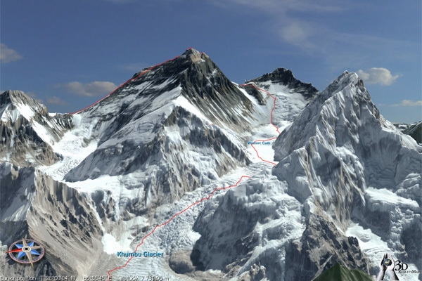
Everest seen from the south
3drealitymaps
Ever wanted to check out Everest close-up? Explore the route through the Khumbu icefall? See how steep it is to climb up the South Face to the Western Cwm before continuing up to the summit of Everest? Or examine the difficult Second Step on the North Face route and the worrying Hornbein Couloir? Well thanks to a new 3D map this is all possible, without the need for supplementary oxygen and from the comfort of your own home.
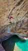
The 3D RealityMap is free and is the result of high resolution satellite images of the Mount Everest region and transformed into a 3D visualization of the highest mountain in the world. A similar technology has been used successfully in the past in other areas, such as the Italian Dolomites where aerial photos have been used to provide nigh milimeter precision. So after having checked out Chomalunga from the north or south we recommend a trip to the impressive Tre Cime di Lavaredo, the mighty Sella group and obviously their Queen, the Marmolada with its sheer south face.
The 3D RealityMap is free and is the result of high resolution satellite images of the Mount Everest region and transformed into a 3D visualization of the highest mountain in the world. A similar technology has been used successfully in the past in other areas, such as the Italian Dolomites where aerial photos have been used to provide nigh milimeter precision. So after having checked out Chomalunga from the north or south we recommend a trip to the impressive Tre Cime di Lavaredo, the mighty Sella group and obviously their Queen, the Marmolada with its sheer south face.
Everest 3D
Note:
| www | |
| www.everest3d.de | |
| www.3dolomiti.it | |
Latest news
07/07/2026
Expo / News


Expo / Products
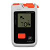

Mammut Barryvox 2 is a compact avalanche transceiver for fast, supported search.
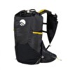

A trail running backpack ideal for running in any weather condition. Thanks to the HDry membrane, this backpack is fully waterproof.

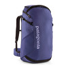
Ferrino Summit 25 is a lightweight, basic backpack designed for climbers and mountaineers seeking the lightest way to carry their gear.
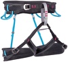

The Aurora is a top-level climbing harness designed specifically for women with special webbing that integrates breathable material with full strength strands for excellent breathability, good load distribution, and great packability.

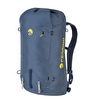
45 liter crag backpack with dual lid and back panel openings.

FURIA AIR continues to set the benchmark for climbing footwear, delivering exceptional sensitivity and an ultra-lightweight feel.