Lengstein - St. Verena - St. Andreas - Ritten

 Copia link
 Nicholas Hobley


 1 / 4
1 / 4 Planetmountain

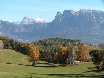
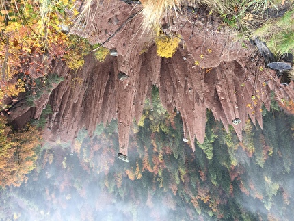
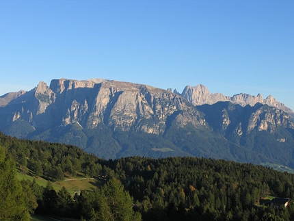
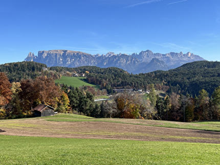
A little known walk which offers splendid views onto the marvelous Schlern, leads past two ancient churches and discovers numerous hidden gems of the Ritten.
The Ritten is located at circa 1200m above the city of Bozen (Bolzano) in the South Tyrol, N. Italy. From Bozen take the SP73 towards Klobenstein (Collalbo). To reach Oberbozen (Soprabolzano) turn off left onto the SP134.
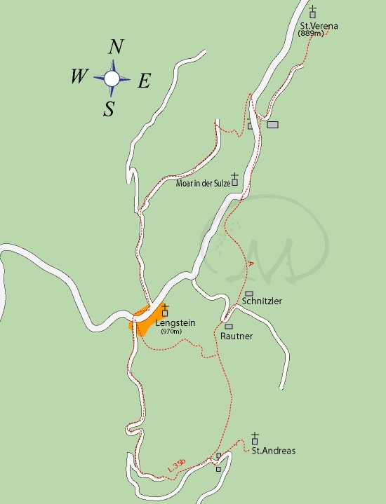
AccessPark the car in front of the church at Lengstein.
ItineraryThe walk starts at the church in Lengstein: walk through the minute tunnel opposite the church and next to the Gasthof, then cross a field to reach the road. Follow this uphill to the fork in the road and turn off right down towards the Waldsteiger and Voglhauser farms. The road comes to an end at the last house and a path, almost completely hidden from view, leads steeply down to the main road which joins Lengstein with Barbian.
St. Verena is clearly visible from the road, but it can only be reached by walking past the farm and taking path N. 35 which leads quickly up to the church. After having enjoyed the view return along this path then continue along the main road to where it steepens sharply. Instead of continuing up past the hairpin bend continue straight past the farmhouse along path N. A until this peters out in the fields. Meander upwards to reach the road, continue up for circa 300m then turn off left for maso Rautner. A small path lead west to another fork: walk up right through the forest to reach Lengstein in just 15 minute, or walk down left towards the delightful St. Andreas church. The position right in front of the Schlern, 700m above the Isarco valley is incredible and it would be a shame to miss it! If the church is closed asked for the key at nearby Gasthof Zuner. The return to Lengstein starts from the Gasthof, initially along the road, then along path N. 35b, then along the road again to reach the village.
Normal hiking equipment.
Maps/BibliographyKompass 1:25.000 RITTEN- RENON
 Comments