Himmelreich (Klobenstein) - Bad Süß - Saltner Hütte - Pemmern - Ritten

 Copia link
 Nicholas Hobley

 - Bad Süß - Saltner Hütte - Pemmern Ritten")
 1 / 4
1 / 4 Planetmountain

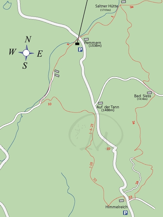
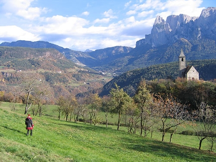
A pleasant and varied walk which starts at the riding school at Himmelreich, reaches the beautiful Bad Süß spa and then continues up to the Saltner Hütte at 1701m. The path leads off this bare mountain and descends the ski piste and stunning slopes shunned by the crowds. It finishes with a long return home through a magnificent forests.
The Ritten is located at circa 1200m above the city of Bozen (Bolzano) in the South Tyrol, N. Italy. From Bozen take the SP73 towards Klobenstein (Collalbo). To reach Oberbozen (Soprabolzano) turn off left onto the SP134.
AccessFrom Klobenstein drive north towards the Rittnerhorn, park circa halfway between Klobenstein and Pemmern at Himmelreich (park on the left at the bar).
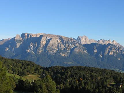
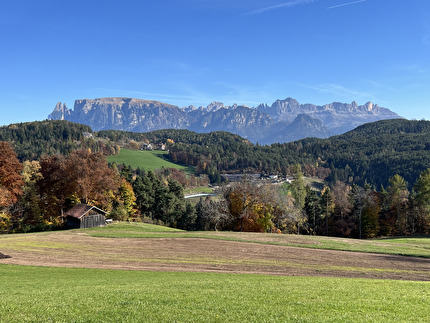
Itineraryross the road and take the dirt track next to the horses, then bear left at the fork down path N.33 which leads to another road and path N. 3a. Follow this past some farms, paying attention to not miss the signs. The path zigzags slowly uphill, then crosses a beautiful field to enter the forest and cross a small stream. From here it rises steeply up the hill to reach Gasthof Bad Süß, a perfect spot for some refreshments and a splendid view onto the Dolomites. The small church is magnificent, as is the old bowling alley!
Our walk continues west up the road towards Pemmern, but only to the gate since it bears right at this point up through the forest. Follow the markers on the trees and boulders for circa 40 minutes to then exit the forest and reach the Saltner Hütte at 1700m, the highest point on this walk. Beware: at one point the path crosses the forest road and continues, almost completely hidden from view, uphill – make sure you don’t get lost here!
From the hut continue west towards the cable cars along path N.1 which leads the the ski piste and down to the cable car station. Cross the parking lot and continue along path N. 9 which leads off to the right of Gasthof Zirm. Leave the crowds behind you and walk towards some beautiful fields and larch trees – possibly the most beautiful part of the entire walk. The path rolls gently downwards into a small valley with a few farms, horses, sheep and… lama! The road runs parallel to a small stream; follow this, then fork left along path N. 10 to ascend NNW back through the woods.
This final flurry leads to the main road, but the walk continues through the woods on the wide path marked N. 1, 6 and 28. 28 is the one to follow as it leads back to the starting point: bear left at the fork, then left again further on down path N. 33 through the thick forest back to Himmelreich.
Normal hiking equipment.
Maps/BibliographyKompass 1:25.000 RITTEN- RENON
 Comments
Show more in Sarntal Alps