Canale Sant Anna

 Copia link
 Eric Girardini, Mountain Guide


 1 / 9
1 / 9
Canale Sant Anna
 Planetmountain
Beauty


By
Eric Girardini, Mountain Guide
Ascent height difference
1000m
Descent height difference
1000m
Difficulty
Alp: F+, Ski: 3.3, Exp: E2
Ascent exposition
South
Descent exposition
West
Route
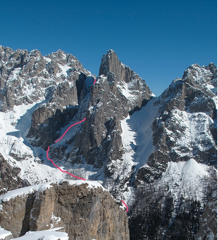
It seems almost impossible that there are still some little known descents in the Pale di San Martino group since this area is highly popular with mountaineers and climbers all year round. And, better still, that these descents are neither extreme nor contorted with long approaches... It seems impossible, but it's true, there really are some little known descents that are both logical and direct and lie close to Rifugio Canali. As such, they are reached by following the summer path that leads to the North Face of Sass d' Ortiga.
Access
From Passo Cereda head towards Agordo and descend to Mis. Continue along the SS 347 and cross the bridge over the river Mis, then take the second left following signs for Domadori, and the Menegazzi bivouac. Continue up the steep and narrow road for as long as possible. Itinerary
Take the forest road on the right that leads to Malga Cavallera and then to the Menegazzi bivouac. From the bivouac head north towards the Vani Alti col following the classic ski mountaineering itinerary. Three hundred meters before reaching the col leave the main valley and ascend the steep, narrow gully below the NE Face of Sass d' Ortiga that leads to Forcella Sant’Anna. Descent
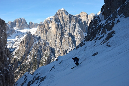
Ski the obvious gully NW until this terminates above a dangerous void. From here traverse right (peg) for about fifteen meters to reach the parallel gully. Ski down the beautiful slope towards the steep and narrow gully on the right (north) that leads to Val Canali; depending on snow conditions, the 5m vertical section can either be skied or breached using the fixed rope and abseil ring.
From here descend towards Rifugio Treviso and then, snow conditions permitting, ski the steep gully behind the hut. Cross the river and continue along the forest road to return to the car.


 See all photos
 Comments
No comments yet...
Beauty
By
Eric Girardini, Mountain Guide
Ascent height difference
1000m
Descent height difference
1000m
Difficulty
Alp: F+, Ski: 3.3, Exp: E2
Ascent exposition
South
Descent exposition
West
Route
Routes in the same mountain group
Related news
14/12/2013 - Snow Ski-skimountaineering
Canalone Sant'Anna, Pale di San Martino Eric Girardini introduces Canalone Sant'Anna, a beautiful a little known ski mountaineering and freeride tour in the Pale di San Martino group, Dolomites.