Hochgasser

 Copia link
 Vittorio Messini, Mountain Guide Kals am Großglockner


 1 / 7
1 / 7 Planetmountain

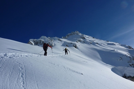
Hochgasser is one of the most beautiful ski tours in the Hohen Tauern. Guaranteed snow conditions due to its geographical location and the ease of access via the Felbertauernstraße ensure that this is a classic outing all season long. Nevertheless its length should not be underestimated and consequently this is recommended for advanced skiers only. Those less expert can ascend up to Grünseehütte and enjoy the marvellous panorama from there!
How to reach East Tirol (Osttirol, Austria):
1) From Munich or Verona via the Brenner motorway to exit at Bressanone. Drive through the Pusteria valley to reach the Italian-Austrian border. Continue from here past Lienz towards Felbertauern to reach the starting points in about 1 hour.
2) From Munich to Salzburg, then continue south to Bischofshofen. Leave the motorway here and drive through the Salzachtal to reach Mittersill. From here take the the Felbertauern road, through the tunnel, to enter the East Tirol.
We drive along the Felbertauernstraße and after 30 minutes reach the Matreier Tauernhaus (1512m).
We put on our skis and follow the forest road behind this mountain hut and ascend past the thinning forest until the landscape opens up and offers view onto the Sexten Dolomites and the Großvenediger. Before reaching the private hut "Grünseehütte" we have to traverse a slope which is over 35 degrees steep. This is one of the crux sections of the ascent and the slope safety must be evaluate carefully! After this we continue up through the wide, south facing valley. Hochgasser is located on the meteorological boundary between the Northern and the Southern Alps and as such is promised guaranteed snow from December to April. We continue past three frozen lakes to reach the final slope which leads to the easy finishing ridge and the summit. From here we can admire the view from the Vienna Alps to Mount Triglav in Slovenia and the Dolomites in Italy, and even on to the Bernina mountain chain.
DescentTo top it all, the 1400m ascent recompenses with one of the most captivating descents of the Upper Tauern in the East Tirol!
NotesContact the Alpine Guides Kals am Großglockner: www.bergfuehrer-kals.at
East Tirol Tourist office: www.osttirol.com
For the Hochgasser peaks we recommended the Austrian Alpine Club map (AV Karte Nr. 36 Venedigergruppe).
New for 2012: the ski touring guidebook of East Tirol by Thomas Mariacher
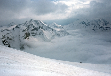
: the start © Guide Alpine Kals am Großglockner")
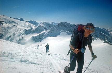
: above the Matreier Tauernhaus © Guide Alpine Kals am Großglockner")
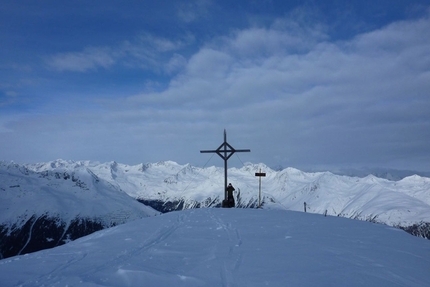
: above the Grünseehütte © Guide Alpine Kals am Großglockner")
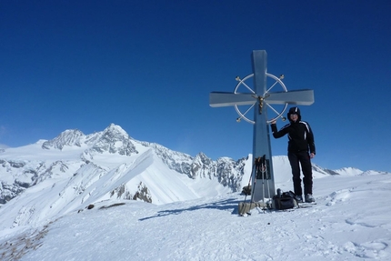
: the descent © Guide Alpine Kals am Großglockner")
: the descent © Guide Alpine Kals am Großglockner")
: the descent © Guide Alpine Kals am Großglockner")
 See all photos
 Comments