Giro della Croda da Lago

 Copia link
 Mario Dibona, Mountain Guide


 1 / 3
1 / 3 Planetmountain

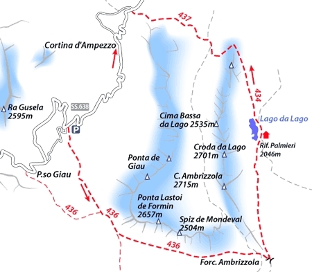
This is a demanding and beautiful itinerary that leads away from Passo Giau to cross Forcella Giau and Forcella Ambrizzola before descending to the Croda da Lago towers and Lago dell’Edera. Without a doubt one of the most beautiful itineraries in the area.
From Cortina d’Ampezzo take the SS 48 towards Passo Falzarego and turn left onto the SS 638 at Pocol for Passo Giau.
AccessAt a hairpin bend at 2025m park on the right.
ItineraryFrom the car park head SE to immediately catch sight of the first stage of the itinerary, Forcella Giau. Usually there is an obvious line of ski mountaineering tracks to follow, easily at first, then more steeply to beneath the col proper (path no. 436). The view from here is fantastic: Monte Pelmo straight ahead, Civetta on the right and, stretching out deep below, the entire Mondeval plateau.
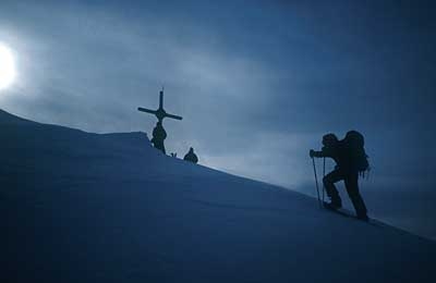
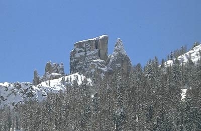
Traverse beneath the immense “Lastoi de Formin” walls following path no. 436 and, heading towards the Becco de Mezodi, reach Forcella Ambrizzola (2277m). This is another outstanding viewpoint: the Ampezzo valley extends below while the Croda da Lago walls, towering high above the tiny refuge, reflect in the waters of Lago dell’Edera (or Lago da Lago).
Head sharply north along path no. 434, signposted for “Rocurto”, down to the refuge (open throughout winter). Walk alongside the right-hand side of the lake to then continue along Val Negra. An initial flat section is followed by a decidedly steep slope at the end of the rocky outcrop “Ciadenes”. Negotiate this slope carefully to reach Casone di Formin at 1885m. From here take care in finding path no. 437 which crosses the river “Ru Formin” on the left; do not be misled by the tracks left by skiers who continue north towards Pezziè de Parù. The path now winds its way west, losing height slowly, to reach the bridge at Rocurto and then the main road.
From Ponte di Rocurto return by second car, left here earlier on in the day.
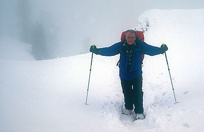
GearNormal equipment for winter walking, snowshoes and poles, lightweight crampons. Given the length of the itinerary take plenty to drink.
DifficultySnowpack must be well bonded and stable.

 Comments