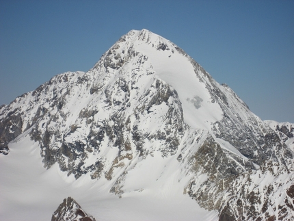
Punta San Matteo

 Copia link
 Planetmountain


 1 / 3
1 / 3
Punta San Matteo
 Planetmountain
Beauty


By
Planetmountain
Ascent height difference
1500m
Descent height difference
1500m
Height
3678m
Difficulty
Difficult
Time
4 -5 hours
Ascent exposition
E, N
Descent exposition
N
Period
Spring
Route
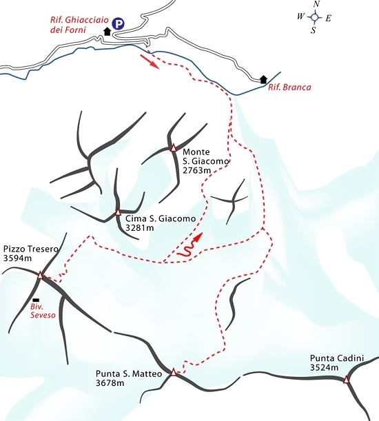
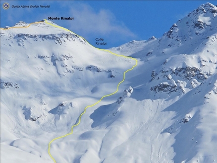
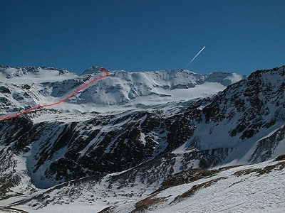
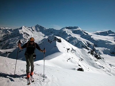
One of the most popular, classic outings in this glacial environment. A long itinerary with significant height gain.
Access
Rifugio Forni is the starting point for this ascent. From Bormio in Alta Valtellina (reach this from Sondrio in Lombardy or, for those coming from the Trentino, by crossing Passo dell'Aprica) continue up the valley to S. Caterina Valfurva and from here turn off left up the steep road to the mountain hut. Telephone prior to departure to check the road conditions on this final stretch. Itinerary
From the car park at Rifugio dei Forni follow the road to the dam (hyrdrographic right). Cross this at its base and put your skis on the hydrographic left. Ascend the valley, either by traversing high or by ascending up the valley bottom. Continue past Rifugio Branca which is clearly visible on the opposite side of the valley to reach the base of the Forni glacier.
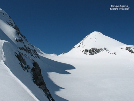
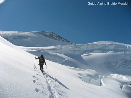
Continue upwards in the same direction and pass the large descent gully wide that descends from Pizzo S. Giacomo to reach the glacier proper. Continue on its right-hand side (hydrographic left) past a level plain. After this the line of ascents turns right and ascends the steep slope, weaving its way without difficulties past the large open crevasses. This section leads to the base of the wide glacial slopes at the base of the north face of S. Matteo. Start ascending rightwards towards S. Matteo and then turn off left up steeper slopes. Once past these reach a plain and then continue towards the S. Matteo face, then rightwards once again to ascend up a nice slope which coasts beneath seracs and leads to the final slopes. Climb these left and zigzag up to the summit crest. Follow this right (west) to the summit. Descent
Descend along the line of ascent. Gear
Normal ski mountaineering equipment. Maps/Bibliography
Ortles - Cevedale Tabacco, foglio 08, 1:25.000
Rifugio Forni is the starting point for this ascent. From Bormio in Alta Valtellina (reach this from Sondrio in Lombardy or, for those coming from the Trentino, by crossing Passo dell'Aprica) continue up the valley to S. Caterina Valfurva and from here turn off left up the steep road to the mountain hut. Telephone prior to departure to check the road conditions on this final stretch. Itinerary
From the car park at Rifugio dei Forni follow the road to the dam (hyrdrographic right). Cross this at its base and put your skis on the hydrographic left. Ascend the valley, either by traversing high or by ascending up the valley bottom. Continue past Rifugio Branca which is clearly visible on the opposite side of the valley to reach the base of the Forni glacier.
Continue upwards in the same direction and pass the large descent gully wide that descends from Pizzo S. Giacomo to reach the glacier proper. Continue on its right-hand side (hydrographic left) past a level plain. After this the line of ascents turns right and ascends the steep slope, weaving its way without difficulties past the large open crevasses. This section leads to the base of the wide glacial slopes at the base of the north face of S. Matteo. Start ascending rightwards towards S. Matteo and then turn off left up steeper slopes. Once past these reach a plain and then continue towards the S. Matteo face, then rightwards once again to ascend up a nice slope which coasts beneath seracs and leads to the final slopes. Climb these left and zigzag up to the summit crest. Follow this right (west) to the summit. Descent
Descend along the line of ascent. Gear
Normal ski mountaineering equipment. Maps/Bibliography
Ortles - Cevedale Tabacco, foglio 08, 1:25.000
 Comments
No comments yet...
Beauty
By
Planetmountain
Ascent height difference
1500m
Descent height difference
1500m
Height
3678m
Difficulty
Difficult
Time
4 -5 hours
Ascent exposition
E, N
Descent exposition
N
Period
Spring
Route
Routes in the same mountain group
Related news
29/04/2005 - Snow Ski-skimountaineering
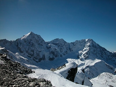
Cevedale: ski mountaineering in Italy One of the most important Italian mountain chains for spring ski mountaineering: Cima Madriccio, Cima Marmotta, Palon de la Mare, Pizzo Tresero, Punta San Matteo.