Sass da Putia East Face

 Copia link
 Enrico Baccanti and Francesco Tremolada, Alta Badia Guides


 1 / 4
1 / 4
Sass da Putia East Face: © Enrico Baccanti
 Planetmountain
Beauty

By
Enrico Baccanti and Francesco Tremolada, Alta Badia Guides
Ascent height difference
1300m
Descent height difference
1300m
Height
2875m
Difficulty
ALP: PD, SKI: 4.3, Exp: E3
Time
4 h
Descent exposition
E+S
Departure
Longiarù in Val Badia
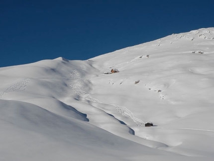
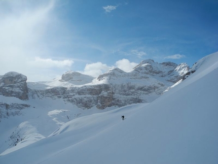
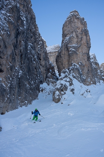
A steep skiing itinerary which gives you the possibility to ski down from the summit of Sass da Putia down the sunny side which looks over Val Badia. The first descent was made by Heini Holzer during the seventies.
Access
Longiarù in Val Badia. Longiarù is reached from San Martino in Badia, which can be easily reached by turning onto the road (244) which joins Brunico to the villages in Alta Badia. Once you cross the town of Longiarù follow the road which climbs up the valley with the same name till you reach the hamlet of Seres. Park your car near the beginning of the forestry road (marked n°4). Itinerary
Follow the road heading into the valley, till you reach a junction which leads to Rifugio Genova (sign posts). From here continue to the right along the road, crossing the torrent and following sign posts for Utia Vaciara till you reach the slopes at the base of the wall. Climb up this using ice axe and crampons, along the evident central couloir and traversing to the right (exposed, not always covered in snow) to reach the final part where you need to pick the best itinerary for the successive descent. Descent
From the summit’s cross ski down your uphill tracks, being careful down the first steep section which has rocks sticking out and is exposed to a rock step which hangs over the couloir. Gear
Ice axe and crampons Notes
This itinerary requires abundant snow, but it has to be safe, be careful in choosing the right moment to ski down. Other possibilities: If the conditions are not ideal you can ski down the normal route (easy climbing with equipped sections) to reach itinerary Piccolo Putia. Maps/Bibliography

 Comments
No comments yet...
Beauty
By
Enrico Baccanti and Francesco Tremolada, Alta Badia Guides
Ascent height difference
1300m
Descent height difference
1300m
Height
2875m
Difficulty
ALP: PD, SKI: 4.3, Exp: E3
Time
4 h
Descent exposition
E+S
Departure
Longiarù in Val Badia
Routes in the same mountain group

Related news
07/03/2013 - Snow Ski-skimountaineering
Dolomites ski mountaineering: the Puez Odle group Four ski mountaineering routes in the Puez Odle group of the Dolomites presented by Enrico Baccanti and Francesco Tremolada, Alta Badia Guides: Antersasc North Gully, Crep da le Dodesc, Munt...