Triglav traverse

 Copia link
 Claudio Fava


 1 / 4
1 / 4
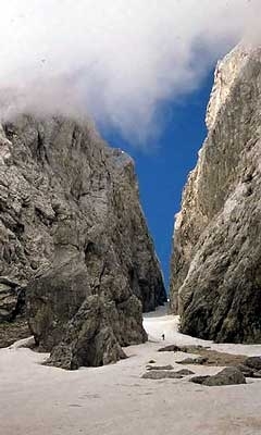
Triglav traverse: Kanjavec from the south
 Planetmountain
Beauty

By
Claudio Fava
Ascent height difference
2700m circa
Descent height difference
2450m
Height
2864m
Difficulty
Difficult
Time
3 days
Ascent exposition
N, W, S
Descent exposition
N, W, S
Period
Spring
Route

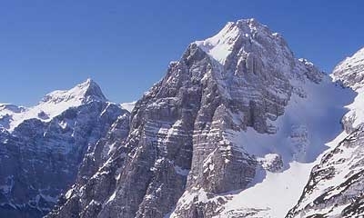
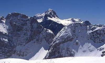
To get to know Triglav and the surrounding area there is nothing better than a multi-day treaverse. The itinerary published below starts from the Valle dell'Isonzo close to Trenta and its magnificent river, reaches the upper section of the Valle dei Sette Laghi, ascends Mt Kanjavec and then traverses north to Triglavski Dom. After an almost obbligatory ascent of Triglav the route descends down the long Za Cmiron valley to finish at Val Vrata.
Access
Drive to Trenta; immediately after the village turn off right in the hairpin bend and continue up this for about 1 km to the metal pole. Itinerary
Day 1
Val Zadnjica 700m - Zasavska Koca 2071m
Height gain: 1371m
Technical difficulty: **
Overall difficulty:***
Orientation: nord, ovest
Time: 3.30 ore
Follow the path to the end of Val Zadnjica and then proceed right to gradually gain height through the wide gully that leads to col Cez Dol 1632m. From here continue up left along a narrow ledge southwards to reach a small valley (if there is plenty of snow it may be safer to descend to beneatht the col and then ascend steeply to reach the base of the valley). proceed up through this valley to reach open terrain; head towards the wide shoulder to the left of Zadnja Lopa. from here continue northwards to reach Zasavska Koca 2071m (the bivy close to the refuge is open all year round).
Day 2
Zasavska Koca 2071m � Kanjavec 2568m - Triglavski Dom 2515m
Height gain: 1000m
Technical difficulty: **
Overall difficulty:***
Orientation: prevalente sud
Time: 5 ore
From the refuge descend into the Rjavo jezero basin and then continue in a wide curve eastwards to reach the foot of Kanjavec's southern slopes. A beautiful ascent leads up to the summit, from where the itinerary continues down the south east crest to reach the Cez Hribarice col. Continue steeply left down Velska dolina to reach 2100m. From here begin the long uphill traverse east to reach Dom Planika 2401m. Continue NE past the refuge to meet up with the itinerary that leads up to Val Krma. A final ascent leads past steep slopes and Triglavski Dom 2515m.
Day 3
Triglavski Dom 2515m � Triglav 2864m � Val Vrata 950m
Height difference: ascent 349m, descent 1914m
Technical difficulty: ***
Overall difficulty:**
Orientation: north
Time: ascent and descent from the summit to the refuge 2 hours; a further 2 hours to descend Val Vrata
The final stage leads to the summit of Triglav before descending into Val Vrata. For a detailed description refer to the Triglav ascent.
 Comments
No comments yet...
Beauty
By
Claudio Fava
Ascent height difference
2700m circa
Descent height difference
2450m
Height
2864m
Difficulty
Difficult
Time
3 days
Ascent exposition
N, W, S
Descent exposition
N, W, S
Period
Spring
Route
Routes in the same mountain group