Giro De Antruilles

 Copia link
 Mario Dibona, Mountain Guide


 1 / 2
1 / 2 Planetmountain


Nestled between Croda De’Ancona and Taburlo, this easy round trip enters right into the heart of the natural park of the Dolomites of Ampezzo. It leads to the buildings of the “Regole di Cortina”, the thousand year old institution for the collective and individual use of the Ampezzo territory. This consortium represents the historical and cultural foundations of the original settlers and has, throughout the centuries, safeguarded this splendid territory.
From Cortina take the SS 51 towards Fiammes.
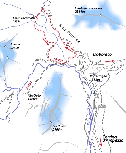
AccessDrive past the Castello di Podestagno and continue on towards Passo Cimabanche. After a few kilometres turn off left at the hairpin bend (Km 111, sign for Parco Naturale d'Ampezzo) onto the small road that leads up to the hut "Ra Stua”. Drive up to the "S'Uberto” clearing (1428m).
ItineraryFollow signs for the "percorso pedonale - Malga Ra Stua" and take the path into the thick woods. Keep left of the road that leads up to the Malga Ra Stua to then meet up with it once more at "Sote Son Pouses" (1515m). Continue along the road, first slightly uphill then flat, to reach a large boulder with signs for "Antrulies - Col Becchei - Lago di Limo". Descend along this mule path to a first bridge, then a second, close to the beautiful buiding "Casone de Antruilles" (1527m). After a short rest here continue towards "Pian de Loa-Fiammes" along the path in a large arch rightwards and slightly downhill. At the end of the descent the path rises once more up to the large outcrop that protects from the ravine, formed by the river "Aga de Ciampo de Cròs". A welcoming bench looks out onto the park and the descent below, which continues on to "Pian de Loa" before coasting along the cross-country piste to "Cason de pian de Loa". In front of this building an enormous fir tree stands high above all the rest: this is the highest tree in Cortina (wrap your arms around it to see just how large the trunk is). Walk next to the piste so as not to ruin the tracks and continue to Fiammes to a bridge and, following signs for "Malga Ra Stua” complete the final, short but steep section back to "S'Uberto” and the parking lot.
DescentThis is a round trip that starts and finishes at the clearing at "S'Uberto”.
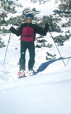
GearNormal equipment for winter walking, snowshoes and poles. Binoculars recommended.
DifficultyNo obvious danger. The itinerary can also be carried out during snowfalls.

 Comments