Dent d'Hérens

 Copia link
 Francesco Vascellari, Loris de Barba


 1 / 5
1 / 5 Planetmountain

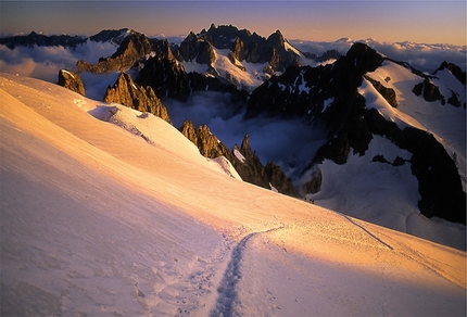
Situated in the Pennine Alps, Dent d’Hérens is far less famous than the Matterhorn to the just to the east. Its pyramidal shape is elegant and harmonious and provides a highly satisfying ski mountaineering ascent. The final section is very alpine, up a steep and often icy slope past outlying rocks that require particular attention. The final section up the ridge is extremely airy and provides spectacular views onto the West Face of the Matterhorn and numerous 4000m mountains in the Vallis Alps.
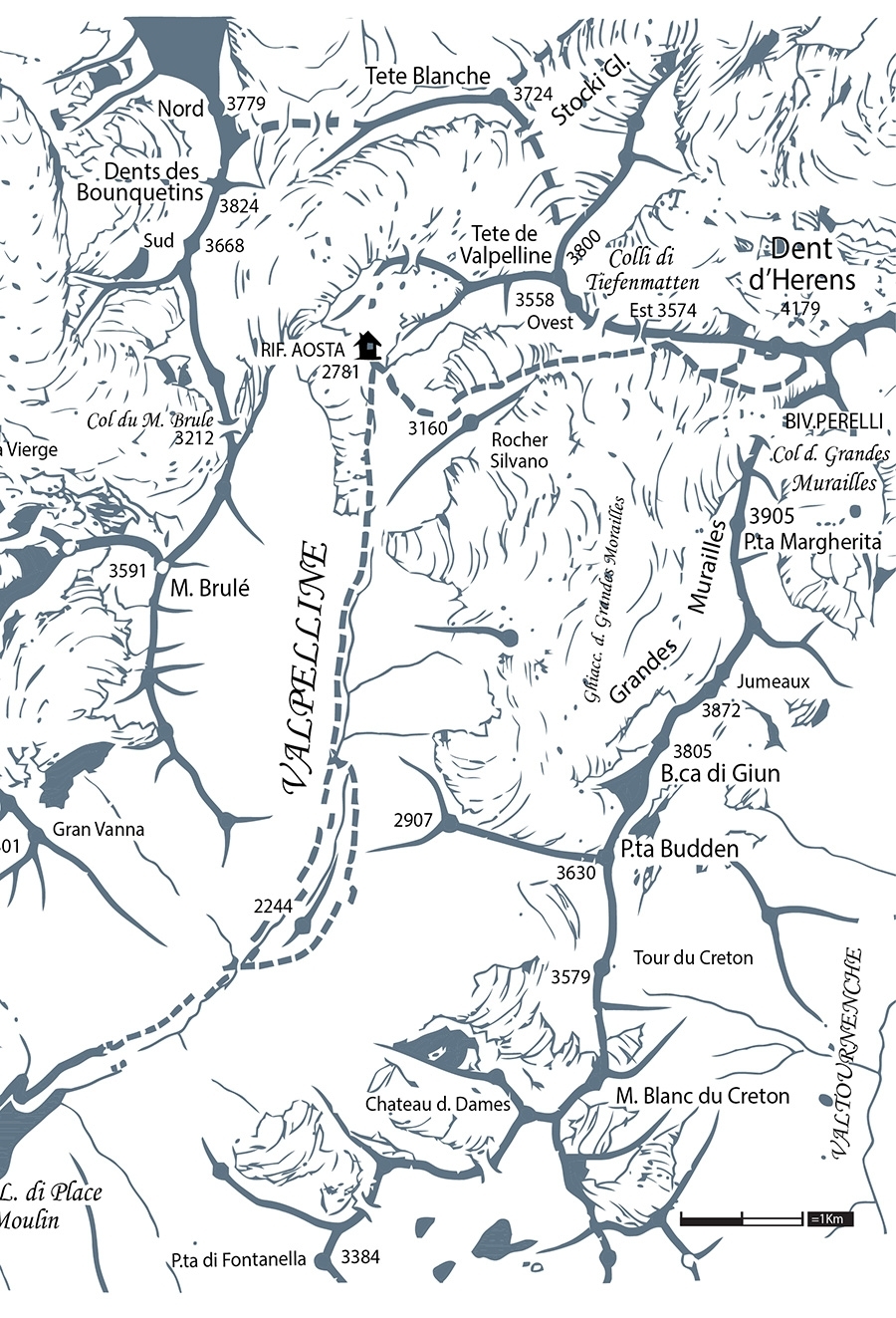
To the hut: From the car park by the Place Moulin dam (1950m) follow the long and flat track that contours the reservoir and leads to the Prarayer pastures (2005m). Continue on the left along the summer path or, in case of abundant snow, cross the bridge to the right of the hill that obstructs the valley. Avoid the gully both on the way up and down. Cross the wide plateau that leads to the bottom of the séracs of the Tsa de Tsan glacier. Overcome an equipped section on the right and reach the Aosta hut (2781m), located at the base of the Tete de Valpelline’s South-West ridge.
Day two: Descend shortly from the hut, then continue to the East on steep slopes that lead to the Grandes Murailles glacier. Bypass on the left a wide and dangerous area full of crevasses to reach a wide plateau. From here, cross the plateau towards the left and gain some height to reach the bergschrund, were the skis can be left. Climb the wall above with ice axe and crampons, amongst snow fields and surfacing rocks then, after a steeper section, reach the West ridge (3920m). Follow this on mixed terrain, bypassing some rocky spurs to the false summit, then continue along the aerial crest and reach the summit.
An alternative for those who might find this too challenging is to climb to the Dent d’Heréns’s East shoulder (4075m). From the plateau at 3550m, aim for Col des Grandes Murailles (3827m), where the Perelli bivouac is located. Just before this, turn left and reach the shoulder through steep ground. This option is easier and more skiable.
As for ascent.
NotesRifugio Aosta (Bionaz-Valpelline IT) - Posti letto 30, locale invernale 14, Tel. +39 0165 730006
Maps/Bibliography4000m Peaks in the alps. Ski Touring | Steep Skiing. By ViviDolomiti Edizioni www.vividolomiti.it
 Comments