Pizzo Bernina

 Copia link
 Francesco Vascellari, Loris de Barba


 1 / 4
1 / 4
Pizzo Bernina
 Planetmountain
Beauty

By
Francesco Vascellari, Loris de Barba
Ascent height difference
Day 1: 900m (rif. Marinelli); Day 2: 1150m
Height
4049m
Difficulty
OSA, S4
Time
7 hour ascent to summit,3:30 to Rif Marinelli
Ascent exposition
South
Descent exposition
South
Departure
Diga di Campo Moro (1880m), Valmalenco
Route

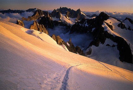
Pizzo Bernina is the easternmost fourthousander in the western Alps: due to the way its formed, it leads into a massif comprised of long ridges that extend all the way to Palù at Piz Roseg. The ski touring ascent follows the normal route from Rifugio Marco e Rosa which can be reached via long and at times technical ascents from either from Italy or Switzerland. The other skiing possibilities belong to the world of steep skiing, explored above all by Giancarlo Lenatti “Bianco”.
Itinerary
Marinelli way (from Valmalenco)
The Marinelli hut, built in 1880 by the Italian Alpine Club (CAI), represents the perfect spot to break the ascent to Bernina into two, and to potentially link some of the other beautiful summits nearby together.
To the hut: Leave the car by the last dam at Campo Moro (1990m), then continue to a rise where it is possible to put the skis on. From here, follow the slope that leads to Alpe Musella, then along the famous “seven sighs” to the Carate hut (2636m). From here, quickly climb to Bocchetta delle Forbici (Forbici saddle), and start a long diagonal traverse on the Scerscen valley to a rocky spur where the Marinelli hut is located (reach it with a short detour on the right, possibility to spend the night here or at the Marco e Rosa hut). From the Marinelli hut, climb to the Western saddle of the same name and to the high Scerscen glacier. From here, continue North and climb the Cresta Guzza’s couloir (on the left, where it is less steep), reaching the Marco e Rosa hut (3597m). From the hut, climb to the shoulder that leads to the Piz Bernina’s South-East ridge, where it is possible to leave the skis. After the first rocky steps, the ridge becomes flatter and narrower. Continue to the Italian summit (4021m), then reach the Swiss summit on easy but very exposed ground (4049m).
Diavolezza way (from Diavolezza)
This itinerary requires good snow conditions and good visibility. There are plenty of crevasses, therefore it is necessary to rope up. The steep slope to the summit and the ridge require stable footing and concentration.
To the hut: Take the Diavolezza cable car to the Berghaus Diavolezza hotel (top station, 2973m). It is possible to climb along the ski slope with an extra 2 hours. From here, continue to the left (East) for 50-100m and descend towards the Vadret Pers glacier. Cross this on almost flat ground towards Fortezza, then skirt the base of its North-East side and climb to the snowy North shoulder (3225m). Move to the West side and climb along the crest to reach a dangerous traverse towards the South that requires attention. This hard passage gives access to a gentle plateau. Descend South-West to reach a highly crevassed area known as “Buuch” (pay attention, sometimes it is not possible to cross it). Climb the steep slope at a height of 3174m, then quickly descend and continue towards Piz Bernina and Fuorcla Crast’Agüzza (South-West direction, crevasses).
Without reaching Fuorcla, climb to the north-West below the South ridge’s rocks to La Spedla or “Spalla” (Shoulder), where it is possible to leave the skis. From here, follow the itinerary from Valmalenco and continue along the long and exposed rocky ridge to the summit. Descent
As for ascent. Take into account the hard ascent from the Vadret Pers glacier to the Diavolezza col, then it is a quick descent back to the car. Notes
Rifugio Marco and Rosa (3597m) - Posti letto 48, locale invernale 34, tel. +39 0342515370
Rifugio Marinelli Bombardieri (2813m) - Posti letto 210, locale invernale 8, tel. +39 0342511577
Chamanna Diavolezza (2973m) - Posti letto 210, locale inv… Maps/Bibliography
4000m Peaks in the alps. Ski Touring | Steep Skiing. By ViviDolomiti Edizioni www.vividolomiti.it
 Comments
No comments yet...
Beauty
By
Francesco Vascellari, Loris de Barba
Ascent height difference
Day 1: 900m (rif. Marinelli); Day 2: 1150m
Height
4049m
Difficulty
OSA, S4
Time
7 hour ascent to summit,3:30 to Rif Marinelli
Ascent exposition
South
Descent exposition
South
Departure
Diga di Campo Moro (1880m), Valmalenco
Route
Routes in the same mountain group
Related news
21/12/2016 - Snow Ski-skimountaineering
4000m Peaks in the Alps. Ski Touring and Steep Skiing Francesco Vascellari and Loris de Barba introduce '4000m Peaks in the Alps. Ski Touring and Steep Skiing', their guidebook to the 4000m mountains in the Alps. Three routes presented on...