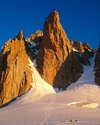
Ski mountaineering in the Upper Tauern, East Tirol, Austria

 Copia link

 1 / 15
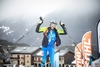
 Guide Alpine Kals am Großglockner
Last week more than 50cm of fresh powder snow fell at Kals am Grossglockner and for the beginning of January this really is an exceptional winter, with roughly 2 metres of snow at the weather station at 2320m. Of the the three ski tours introduced below, Figerhorn is ideal for beginners while Langschneid and Hochgasser are recommended for advanced ski mountaineers only.
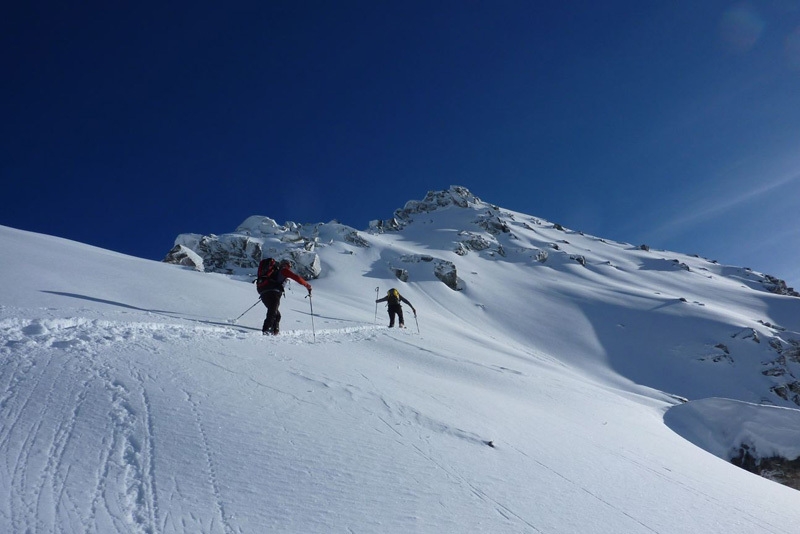
Figerhorn (2743m)
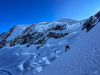
Our starting point is Kals am Grossglockner. Follow the road to the Lucknerhaus (the car park for Großglockner) and park the car circa 0.5 km before the Lucknerhaus, on the right. We put our skis on and ascend the road that leads to the tree line. Wide, gentle slopes open up here, about 25° to 30° steep and we continue up these which seem to have been created perfectly for ski touring, to reach the so-called "Graiwiesen". We leave our skis here and continue on foot, firstly up a steeper slope, then along the easy crest that leads to the summit. With about 900m vertical height gain, a south facing aspect and ideally angled slopes, the Figerhorn ski tour is ideal for beginners but also for advanced skiers if avalanche conditions are not suitable for more demanding itineraries.
Langschneid (2688m)
Continue by car to the nearby village St. Jakob in Defereggental and park at bottom of the ski lifts. We take the lift to the highest point at about 2300m above sea level. From here we ski down the piste for 500m to reach the Bruggeralm (1818m) from where our ascent starts: follow the summer path up to the Ragothalm, where the landscape opens up onto marvellous slopes. We ascend this valley to reach the Ragothlenke pass and enjoy the view onto the highest mountain in the area, Mount Hochgall. From here we follow the easy crest northwards to easily reach the top of Langschneid. There are two descent options: either ski down the ascent route (this is the safest option) or descend via the steeper (circa 35° - 45°), fantastic powder slopes to the north – north east. With a descent of circa 1500m and an ascent of just 870m (thanks to the ski lift), this is certainly one of the ski touring highlights in the Defereggen valley. However, this second descent can only be carried out in safe snow conditions and careful assessment of an expert is therefore paramount!
Hochgasser (2922m)
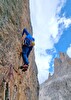
We drive along the Felbertauernstraße and after 30 minutes reach the Matreier Tauernhaus (1512m). Here we put on our skis and follow the forest road behind this mountain hut and ascend past the thinning forest until the landscape opens up and offers view onto the Sexten Dolomites and the Großvenediger. Before reaching the private hut "Grünseehütte" we have to traverse a slope which is over 35 degrees steep. This is one of the crux sections of the ascent and the slope safety must be evaluate carefully! After this we continue up through the wide, south facing valley. Hochgasser is located on the meteorological boundary between the Northern and the Southern Alps and as such is promised guaranteed snow from December to April. We continue past three frozen lakes to reach the final slope which leads to the easy finishing ridge and the summit. From here we can admire the view from the Vienna Alps to Mount Triglav in Slovenia and the Dolomites in Italy, and even on to the Bernina mountain chain. To top it all, the 1400m ascent recompenses with one of the most captivating descents of the Upper Tauern in the East Tirol!
How to reach East Tirol (Osttirol, Austria):
1) From Munich or Verona via the Brenner motorway to exit at Bressanone. Drive through the Pusteria valley to reach the Italian-Austrian border. Continue from here past Lienz towards Felbertauern to reach the starting points in about 1 hour.
2) From Munich to Salzburg, then continue south to Bischofshofen. Leave the motorway here and drive through the Salzachtal to reach Mittersill. From here take the the Felbertauern road, through the tunnel, to enter the East Tirol.
Bibliography:
For the Figerhorn and the Hochgasser peaks we recommended the Austrian Alpine Club map (AV Karte Nr. 36 Venedigergruppe).
For the Langschneid there are two maps: Freytag&Berndt (WK 123) or ÖK Blatt Nr.178
New for 2012: the ski touring guidebook of East Tirol by Thomas Mariacher
For more information:
Contact the Alpine Guides Kals am Großglockner: www.bergfuehrer-kals.at
East Tirol Tourist office: www.osttirol.com
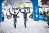
: on the summit, with Grossglockner in the background.")
: the final meters to reach the summit")
: the start")
: heading up to the Graiwiesen")
: the Bruggeralm")
: beneath the col")
: the summit")
: the descent")
: the start")
: above the Matreier Tauernhaus")
: above the Grünseehütte")
: the descent")
 See all photos
| Planetmountain | |
| Ski mountaineering itineraries | |
| MOUNTAIN GUIDES KALS AM GROSSGLOCKNER | |
| www | |
| www.bergfuehrer-kals.at | |